Stanford-le-Hope Roadside
| Pollutant | Band | Concentration | Period | Last updated |
|---|---|---|---|---|
| Nitric oxide (NO) | Not applicable | 1 µg/m3 | hourly mean | 08/07/2026 18:00 |
| Nitrogen dioxide (NO2) | LOW (1) | 16 µg/m3 | hourly mean | 08/07/2026 18:00 |
| Nitrogen oxides as nitrogen dioxide (NOXasNO2) | Not applicable | 17 µg/m3 | hourly mean | 08/07/2026 18:00 |
| PM10 particulate matter (Grav Equiv) | LOW (1) | 15 µg/m3 (Ref.eq) | 24 Hour mean | 08/07/2026 18:00 |
| PM2.5 particulate matter | LOW (1) | 11 µg/m3 (BAM) | 24 Hour mean | 08/07/2026 18:00 |
| Pollutants shown in graph | |
|---|---|
| Parameter | Parameter Name |
| NO | Nitric oxide |
| NO2 | Nitrogen dioxide |
| NOXasNO2 | Nitrogen oxides as nitrogen dioxide |
| SO2 | Sulphur dioxide |
| PM10 | PM10 Particulate Matter |
| NV10 | Non-volatile PM10 |
| V10 | Volatile PM10 |
| PM2.5 | PM2.5 Particulate Matter |
| NV25 | Non-volatile PM2.5 |
| V25 | Volatile PM2.5 |
| Site Information | |
|---|---|
| Altitude | 18m |
| Coordinates (Lat/Long) | 51.518167, 0.439548 |
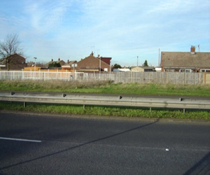
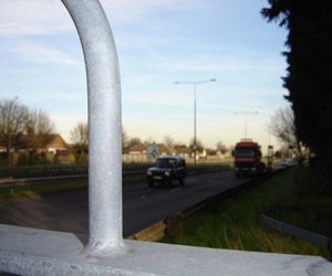
| Environment Type | Roadside: A site sampling between 1m of the kerbside of a busy road and the back of the pavement. Typically this will be within 5m of the road, but could be up to 15m. |
| Kerb Distance | Not Available |
| Height | Metres |
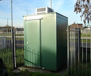
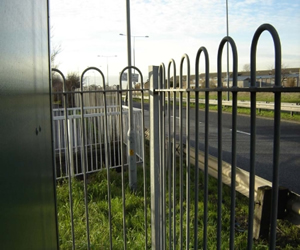
| Site Comments | Monitoring Station located on the south side of the A1014 - The Manorway, approximately 4m from the kerbside. |
| Parameter | Date Started | Date Ended |
|---|---|---|
| Nitric oxide | 22/01/2008 | - |
| Nitrogen dioxide | 22/01/2008 | - |
| Nitrogen oxides as nitrogen dioxide | 22/01/2008 | - |
| Sulphur dioxide | 22/01/2008 | 31/12/2012 |
| PM10 particulate matter (Grav Equiv) | 22/01/2008 | - |
| Non-volatile PM10 | 01/04/2009 | 26/02/2019 |
| Volatile PM10 | 01/04/2009 | 26/02/2019 |
| PM2.5 particulate matter | 01/04/2009 | - |
| Non-volatile PM2.5 | 01/04/2009 | 26/02/2019 |
| Volatile PM2.5 | 01/04/2009 | 26/02/2019 |