Maidstone Upper Stone Street
| Pollutant | Band | Concentration | Period | Last updated |
|---|---|---|---|---|
| Nitric oxide (NO) | Not applicable | 40 µg/m3 | hourly mean | 08/07/2026 18:00 |
| Nitrogen dioxide (NO2) | LOW (2) | 78 µg/m3 | hourly mean | 08/07/2026 18:00 |
| Nitrogen oxides as nitrogen dioxide (NOXasNO2) | Not applicable | 139 µg/m3 | hourly mean | 08/07/2026 18:00 |
| PM10 particulate matter (Grav Equiv) | LOW (2) | 27 µg/m3 (FIDAS) | 24 Hour mean | 08/07/2026 18:00 |
| PM2.5 particulate matter | LOW (2) | 14 µg/m3 (Ref.eq) | 24 Hour mean | 08/07/2026 18:00 |
| Pollutants shown in graph | |
|---|---|
| Parameter | Parameter Name |
| NO | Nitric oxide |
| NO2 | Nitrogen dioxide |
| NOXasNO2 | Nitrogen oxides as nitrogen dioxide |
| PM10 | PM10 Particulate Matter |
| PM2.5 | PM2.5 Particulate Matter |
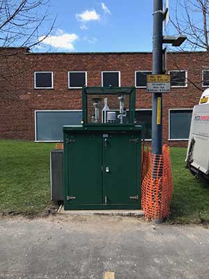
| Site Information | |
|---|---|
| Altitude | 24m |
| Coordinates (Lat/Long) | 51.268519, 0.526348 |
| Environment Type | Roadside: A site sampling between 1m of the kerbside of a busy road and the back of the pavement. Typically this will be within 5m of the road, but could be up to 15m. |
| Kerb Distance | 2m |
| Height | 2 Metres |
| Site Comments | Not Available |
| Parameter | Date Started | Date Ended |
|---|---|---|
| Nitric oxide | 02/12/2016 | - |
| Nitrogen dioxide | 02/12/2016 | - |
| Nitrogen oxides as nitrogen dioxide | 02/12/2016 | - |
| PM10 particulate matter (Grav Equiv) | 09/05/2018 | - |
| PM2.5 particulate matter | 09/05/2018 | - |